Jeremy Point – Shifting Sands of Wellfleet Bay
The name Jeremy Point has been used since at least the 1700s, though its exact origin is uncertain. One popular theory is that it was named for a fisherman or mariner named Jeremy who lived or worked near the point in colonial times. Another possibility is that the name came from early navigation charts, where “Jeremy” marked this distinct sand spit for sailors entering Wellfleet Harbor. Some also believe the name may be a colonial adaptation of a Wampanoag place name that sounded similar.
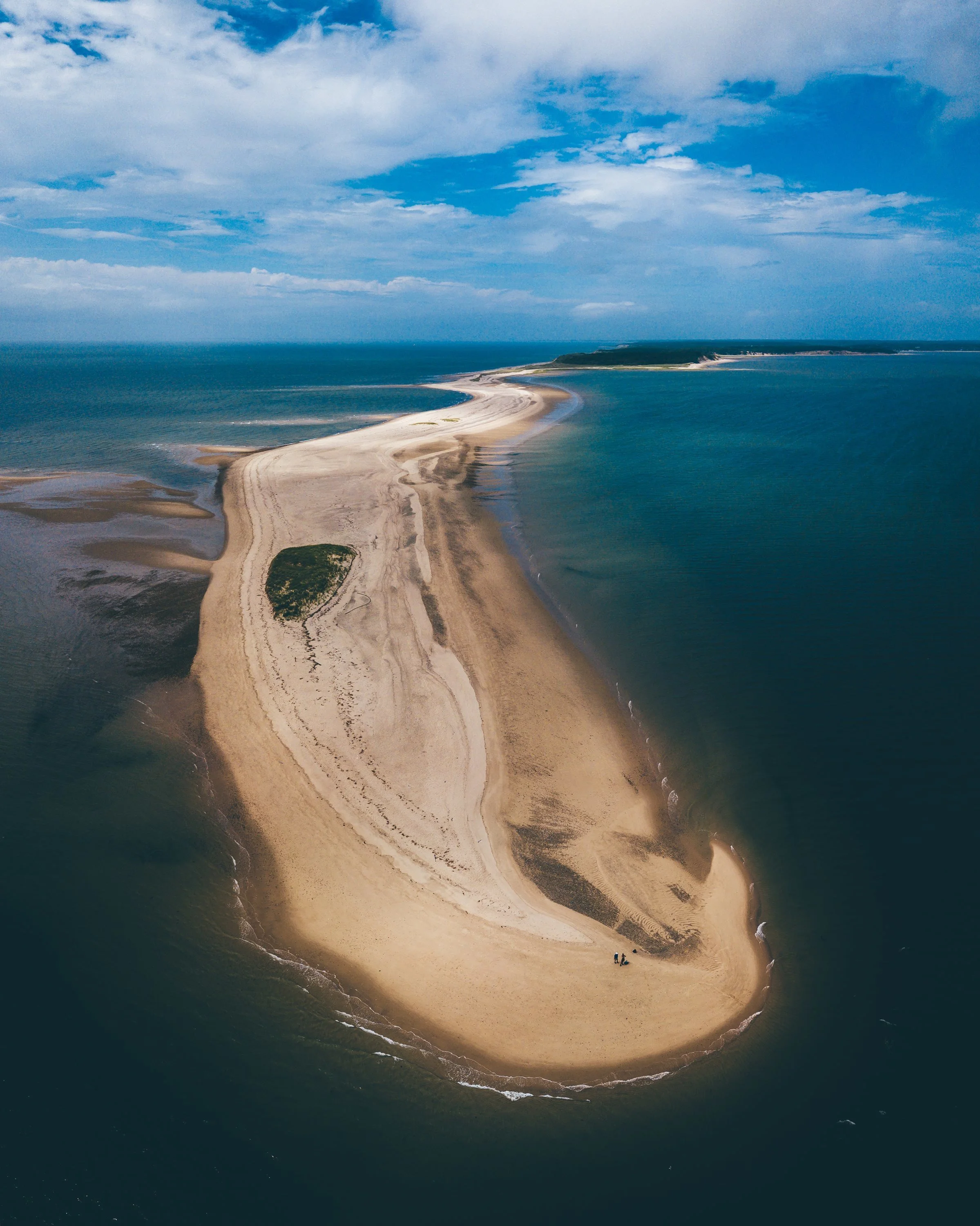
Jeremy Point is a long, curving sand spit stretching into Cape Cod Bay from Wellfleet, creating the natural shelter of Wellfleet Harbor. For centuries, it’s been shaped by wind, tide, and storms—its shape shifting constantly.
Its narrow channel and strong tidal currents have made Jeremy Point a challenging passage for mariners. Over the years, numerous vessels have run aground or wrecked in the shifting sands nearby, particularly before the advent of modern navigation aids. The shoals around Jeremy Point were notorious for snagging fishing boats and coastal schooners, and some wreckage has been uncovered at extreme low tides even in recent years.
In the 19th and 20th centuries, Jeremy Point was a hub for shellfishing, oystering, and hunting. Its tidal flats remain rich in marine life, supporting Wellfleet’s fishing traditions for generations.
Today, Jeremy Point lies within the Cape Cod National Seashore. Accessible by boat or at extreme low tide, it offers sweeping views of Cape Cod Bay, Provincetown, and Great Island. Its ever‑changing sands are a living reminder that Cape Cod’s landscape is always in motion, shaped by nature, storms, and the sea.